
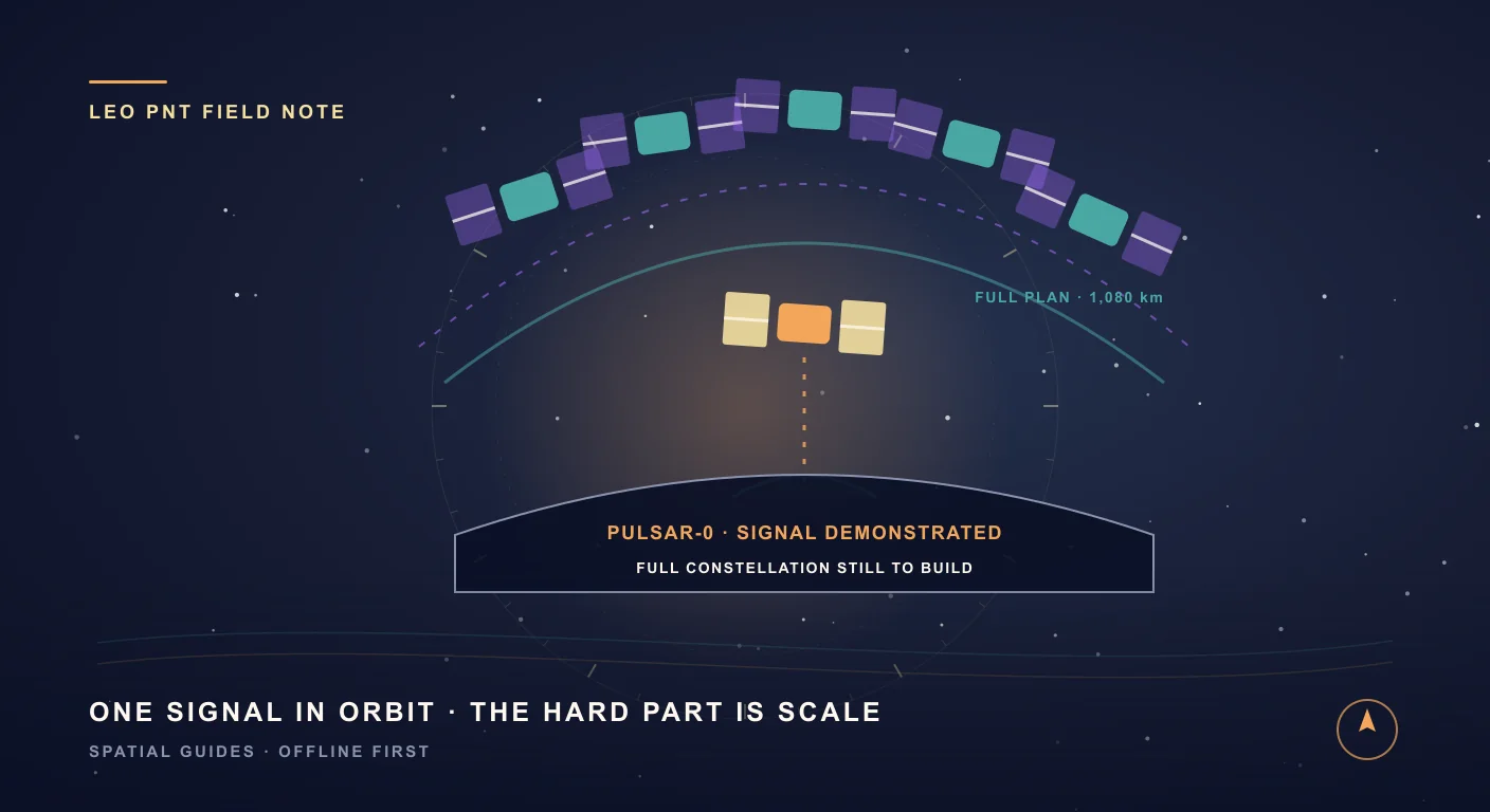
One satellite can prove a signal. It cannot replace GPS.
During a scheduled test pass, Pulsar-0 rises above a receiver’s horizon, broadcasts a new navigation signal, crosses the sky and disappears again. That brief arc contains the entire Xona story: one spacecraft can prove that a signal works in orbit, but only a constellation can turn it into infrastructure.
A navigation constellation is easy to describe and brutally difficult to build. Put precise clocks in space. Broadcast the time. Let receivers measure how long each signal took to arrive. Solve the geometry. The idea fits in a paragraph; the infrastructure takes decades, billions of dollars, international spectrum coordination, ground control, receiver support and enough healthy satellites that several are visible from almost anywhere on Earth.
Xona Space Systems now stands in that gap between proof and infrastructure. During its first year in orbit, Xona says Pulsar-0 supported more than 350 scheduled transmission passes and was tracked on more than a dozen commercial receiver platforms. Engineers changed its software after launch. Yet it still provides intermittent test windows, not a continuous global position. Pulsar is a credible new LEO PNT system under orbital validation; it is not a globally available GPS replacement today.
That distinction makes the story more interesting, not less. As of July 28, 2026, one real spacecraft is forcing an old question into the present tense: if we designed satellite navigation now, with modern radios, software-defined payloads and commercial launch, would we still build it twenty thousand kilometers away?
GPS is not just the blue dot on your map
GPS is often treated as a phone feature, but positioning is only one of its jobs. The U.S. Space Force describes GPS as a global source of positioning, navigation and timing for civilian and military users, with continuous real-time service. Its timing signal helps synchronize telecom networks, electrical grids, financial markets, data centers and scientific instruments. A replacement must be useful long before it is fashionable. It must be measurable, predictable, available and trusted.
GPS satellites orbit at roughly 20,200 kilometers. That high medium Earth orbit gives each spacecraft an enormous footprint, which helps a constellation of a few dozen satellites cover the planet. It also means the signal has crossed a vast distance by the time it reaches a receiver. Civil GPS signals are deliberately engineered to be detected at extremely low power, but weak signals are easier to block with roofs and foliage, overwhelm with radio noise, or confuse with reflections between buildings.
None of this makes GPS obsolete. GPS is mature, global, free at the point of use and supported by billions of devices. Galileo, GLONASS, BeiDou, QZSS, NavIC and augmentation systems make modern receivers more diverse than the word GPS suggests. The strongest case for a new system is therefore not that the existing constellations suddenly stopped working. It is that civilization has asked weak, decades-old space signals to carry more critical work than their original designers could have imagined.
Move navigation closer to Earth and the trade changes
Xona’s current Pulsar spacecraft architecture places satellites at 1,080 kilometers, about one twentieth of GPS altitude. Being closer reduces free-space path loss, but proximity is only part of the power story: Pulsar also uses purpose-built high-power spacecraft and an isoflux antenna designed to distribute signal power across the service area. Xona describes received power up to 100 times stronger than GPS L1 C/A under its design conditions. That is an up to figure, not a promise that every receiver behind every wall gets a hundredfold improvement.
LEO also moves quickly through the sky. A fast-changing line of sight gives a receiver more geometric diversity over a short period and changes reflected paths quickly, which can make multipath easier to identify than a reflection that barely moves. The same speed creates the central cost of the architecture: each satellite covers less ground and remains visible for less time. Continuous service requires frequent handovers and many more spacecraft.
The detailed plan lists 258 satellites across 18 orbital planes: twelve planes of sixteen spacecraft at 53 degrees inclination and six planes of eleven at 97 degrees. Xona’s broader pages sometimes round that to 250-plus or approximately 300. The precise architecture is the useful number; the rounded descriptions communicate the scale. Either way, the wager is clear: build hundreds of smaller, software-defined satellites close to Earth in exchange for a stronger, faster-changing signal.
Pulsar broadcasts dual-band signals called X1 and X5, adjacent to the familiar GNSS L1 and L5 bands. Xona chose that neighborhood so compatible GNSS antennas and RF paths could potentially be upgraded through firmware and software rather than redesigned from zero. Potentially is important. A radio front end still has to pass the frequencies, a chipset has to expose the observations, and a vendor has to implement Xona’s signal, message, encryption and authentication stack.
The satellite is real. Here is what it has actually proved.
Pulsar-0 launched on June 23, 2025 as Xona’s production-class validation satellite. In its one-year orbital report, Xona says the mission supported more than 350 transmission passes across four continents, collected 22 terabytes of observability data, was tracked on more than a dozen commercial receiver platforms and received four major software updates in orbit. Those are meaningful system results: spacecraft, signal, ground operations and receiver implementations met outside a simulator.
- Software-defined operation: Xona changed signal capability and robustness after launch instead of waiting for a new satellite generation.
- Receiver coexistence: commercial receivers have tracked X1/X5 while Xona and industry researchers tested coexistence with GPS and Galileo signals in nearby spectrum.
- Indoor reception: Xona reports acquiring and tracking Pulsar inside its concrete Montréal office and generating timing output there.
- Interference trials: Xona reports live-sky tests in which Pulsar remained receivable after GPS was lost to jamming, reducing the tested jammer’s effective area by as much as 95 percent.
- Authenticated ranging: Pulsar-0 has transmitted a watermarked signal that lets an equipped receiver test whether ranging features match a cryptographic pattern generated by the satellite service.
The most eye-catching number is 1.5 centimeters. Xona says on-orbit updates improved an earlier reported 4.2-centimeter ranging error to what its one-year report calls a best result of 1.5-centimeter native accuracy. The public report does not define that later metric or test method in enough detail to treat it as a complete user-position result, and one satellite cannot independently produce a normal 3D position and receiver-clock solution.
The evidence is also mostly company-reported or produced with partners and research receivers. That does not make it meaningless; early infrastructure is necessarily tested by its builders. It does mean readers should distinguish an orbital engineering result from a broadly available service-level guarantee reproduced across independent consumer hardware.
The spectacular numbers belong to the full constellation
Xona’s Pulsar service specification targets 2-centimeter horizontal and 4-centimeter vertical positioning, timing below 10 nanoseconds, convergence to 25-centimeter accuracy that Xona describes as near-instantaneous, and stronger operation in cities, foliage and some indoor environments. The page labels this as expected performance of the full constellation in open sky. Those words are the boundary between what exists and what is being built.
Today, Pulsar-0 creates scheduled test opportunities as it passes overhead. It does not hover above a city, and one satellite cannot solve four unknowns for a normal 3D position and receiver clock. Persistent regional service needs several satellites visible together; worldwide independent service needs the orbital planes, crosslinks, clocks, ground operations, replenishment and receiver population to mature as one system.
Xona raised a $170 million Series C in March 2026 to expand manufacturing and constellation deployment. The company says its Burlingame factory is beginning production for the planned constellation and is designed for a cadence traditional navigation programs rarely attempt. Money and a factory make the plan more credible. They do not remove launch, spectrum, manufacturing, orbital, commercial and operations risk. Schedules over the next few years remain plans until satellites are deployed and service is declared.
A stronger signal helps with jamming. Authentication tackles a different threat.
Jamming and spoofing are often bundled together, but they are different attacks. A jammer raises the noise floor until a receiver cannot hear the satellite. More received power, forward error correction and a modern waveform can make that harder. A spoofer transmits a believable counterfeit signal and tries to make the receiver calculate a false time or place. Power alone does not prove which signal came from space.
Pulsar’s security design aims to authenticate both navigation data and the ranging signal. Xona describes a constellation-wide delayed-key approach for data authentication and a combinatorial watermark that changes a small subset of ranging-code bits in a pattern a receiver can verify. Pulsar-0 has broadcast authenticated test signals, moving the idea beyond a paper-only design. The commercial model is subscription-based: authorized receivers receive the material needed to decrypt and use service features.
The honest caveat appears in Xona’s own security explanation: no ranging system is entirely spoof-proof, and cryptography does not prevent an attacker from delaying an authentic signal. Authentication raises the cost and lets a receiver test important properties; it does not abolish physics or every relay attack. Likewise, stronger signals improve jamming resilience but do not make a receiver unjammable at arbitrary interference power.
The firmware-update promise has a hardware footnote
One of Pulsar’s most attractive claims is that many existing GNSS receivers can gain support through software or firmware. That is plausible for receiver designs whose antennas, filters, RF front ends and programmable baseband already cover the adjacent X1/X5 signals. It is not a universal spell that turns every GPS chip, watch or phone into a Pulsar receiver. Vendors still control the radio, correlators, measurement interfaces and secure service integration.
Xona launched Pulsar Verified to coordinate that ecosystem. As of the research cutoff, its public device catalog lists verified simulator and test equipment from Keysight and Safran, while receiver products from Septentrio, StarNav, STMicroelectronics and Trimble are marked in progress. That is momentum, but it is also a useful picture of the present market: specialist PNT equipment is integrating first.
The partner list reaches beyond demonstrations. Topcon announced early-adopter access for future high-precision workflows. The UK’s National Physical Laboratory announced a two-year project that will deploy Pulsar-enabled timing receivers and compare their output with UTC(NPL) across Pulsar-0 and early production satellites. Murata and Xona are exploring modules and industrial applications. None of these announcements says that a commodity Android phone can receive Pulsar today.
So is Pulsar a replacement for GPS or a complement?
The answer changes with the deployment phase. Right now, Pulsar is an orbital test signal and an integration program. During early deployment, a handful of LEO satellites can add unusually strong, fast-changing measurements to GPS, Galileo and other GNSS observations. A hybrid receiver can benefit before enough Pulsar satellites exist for a Pulsar-only fix. Xona itself describes that near-term path as augmentation.
- Today: Pulsar-0 validates signals, software, security concepts, operations and compatible receivers during intermittent passes.
- Early constellation: Pulsar measurements can complement legacy GNSS, improve geometry or resilience when visible, and carry timing or correction services.
- Mature constellation: enough simultaneous Pulsar satellites could support an independent LEO PNT solution, subject to coverage, subscription, receiver support and proven service performance.
- Resilient user system: the strongest architecture may use several independent sources rather than betting every critical function on one constellation, one orbit or one operator.
Calling Pulsar a GPS alternative is fair when alternative means another independently engineered source of PNT. Calling it a current drop-in replacement is not. The likely transition is additive: GPS remains, Pulsar arrives beside it, and receivers decide how much trust and weight to give each measurement.
The spacecraft broadcasts a possibility. The receiver builds a position.
A navigation signal does not arrive as latitude and longitude. It arrives as time, code phase, carrier phase, Doppler, data bits and noise. The receiver must identify the satellite, recover its orbit and clock state, form a range, account for signal transit and atmosphere, estimate its own unsynchronized clock, reject observations that do not agree and solve a nonlinear geometric problem. Better measurements make every stage easier, but they do not remove the stages.
- Acquisition and tracking decide whether a faint or moving signal can be followed continuously.
- Navigation-message decoding tells the receiver where the satellite was and what its clock was doing when it transmitted.
- Observation modeling corrects Earth rotation, satellite clocks, atmosphere, hardware biases and signal-specific delays.
- Weighting and integrity checks keep one reflected or corrupted measurement from dragging the whole solution away.
- The position solver estimates location and receiver time, then filters successive epochs without hiding real uncertainty.
This is the point where the Pulsar story finally meets SIMT. Not because SIMT receives Xona’s signals, and not because the companies are affiliated. It meets SIMT because raw receiver software is where a new satellite signal becomes useful to a person.
What SIMT’s GNSS engine does today — and what it does not
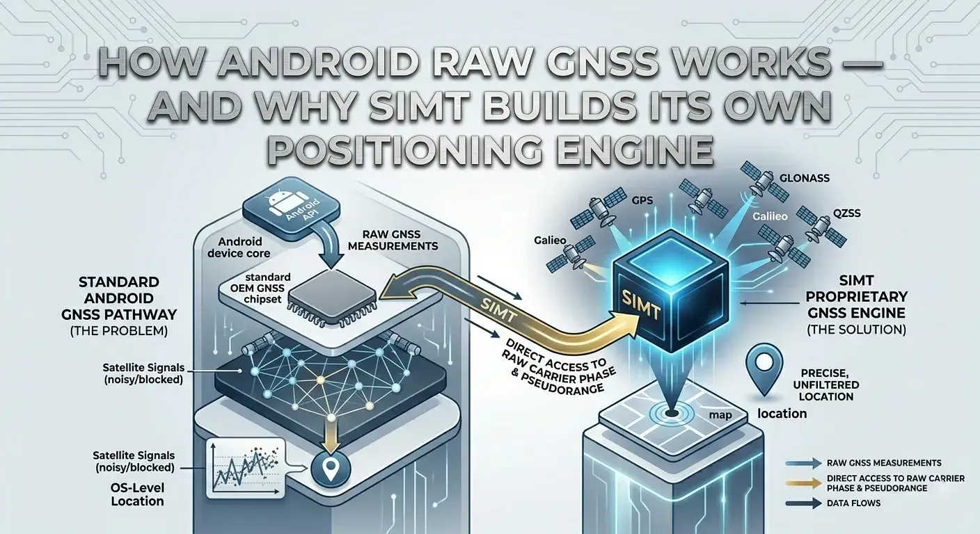
On supported Android phones, SIMT works with the raw GNSS measurements the operating system and chipset expose today. Its GNSS screen can compare Google’s fused location, Android’s standard GPS-provider fix and SIMT’s own raw-measurement solution. The custom path processes supported navigation data from GPS and QZSS, Galileo, BeiDou, GLONASS and SBAS instead of accepting a final black-box coordinate.
The engine forms pseudoranges, smooths code with carrier phase or Doppler when available, combines valid L1/L5 measurements on dual-frequency hardware, propagates satellite orbits, models clock and atmospheric effects, estimates a clock state for each constellation, and solves an iterative weighted least-squares position. Standardized residual checks reject inconsistent observations, and an inter-epoch Kalman filter steadies the result without pretending a noisy fix is certain.
Optional correction modes extend that pipeline. PPP consumes orbit and clock corrections over NTRIP and remains a float-ambiguity, decimeter-to-meter tool after convergence. RTK uses observations from a nearby base station: its float solution can reach decimeter class when the geometry and observations are suitable, while centimeter-class fixed RTK additionally requires clean carrier tracking and a successful integer-ambiguity ratio test. Clear sky, antenna quality, phone hardware, multipath, correction availability and time to converge still decide the real result. Indoors, raw GNSS is not SIMT’s answer; fused or sensor-based methods are more appropriate.
Keep reading See the complete receiver-side journey inside SIMT, from Android timing measurements and satellite ephemeris to corrections, integrity checks and a finished position.How Android Raw GNSS Works — and Why SIMT Builds Its Own Positioning Engine Your phone receives timing signals from dozens of satellites every second. Most apps never touch that data. SIMT does — and it builds a full positioning engine from raw measurements, carrier phase, broadcast ephemeris, and atmospheric models to push accuracy far beyond what standard GPS gives you. Keep reading For the other side of the sky, learn how SIMT turns a published orbit into live azimuth, elevation and an offline pointing target.How to Track Satellites with SIMT: Aim a Dish, Spot the ISS, and More From aiming a satellite dish to catching the ISS overhead, SIMT turns any satellite into a direction you can actually point at. Feed it a TLE and it computes the live azimuth, elevation, and range on your device, then guides you there with the compass and Iris AR, even with no signal.What would have to happen before Pulsar matters to an Android app
A future Android integration would begin below the app. The phone’s antenna and RF front end would need to pass X1/X5. The GNSS chipset and OEM firmware would need correlators and signal support. Android would need to expose usable measurements and metadata rather than swallowing the new signal inside a proprietary fused fix. Xona’s specifications, SDK and subscription controls would need to be available under terms an implementation could use.
- Prove compatible RF hardware and chipset tracking on the actual phone models, not only a simulator or survey receiver.
- Expose X1/X5 code, carrier, Doppler, timing state and signal identity through a stable Android interface.
- Implement and validate Pulsar navigation messages, orbit and clock models, service data, encryption and range authentication.
- Add the LEO constellation’s timing and state model to the multi-constellation solver without treating it as GPS under another name.
- Test mixed GPS/Galileo/BeiDou/GLONASS/Pulsar solutions, handovers, interference, multipath, failure modes and accuracy against independent truth data.
- Ship only after field evidence supports the claims users see in the interface.
That list is deliberately longer than add a constellation toggle. The compelling thing about software-defined navigation is that capability can move quickly. The reassuring thing about a trustworthy position engine is that it refuses to move faster than its evidence.
The next milestones that will tell us whether Pulsar changes navigation
- Production launches: not only spacecraft announcements, but healthy satellites reaching operational orbit and broadcasting repeatably.
- Persistent coverage: the point where scheduled passes become a regional service with enough simultaneous satellites for useful geometry.
- Independent positioning results: complete user position and timing performance across receivers and environments, not only one-satellite ranging records.
- Verified receiver products: commercial hardware moving from in progress to shipping, with clear supported features and service terms.
- Hybrid behavior: published evidence showing how much Pulsar improves existing GNSS before Pulsar-only coverage exists.
- Security under realistic attacks: authentication latency, replay and delay handling, key operations, jamming limits and clear receiver warnings.
- Commodity chipset access: concrete support in mobile or embedded platforms rather than the assumption that every L1/L5 device is one firmware update away.
Pulsar is worth watching because it has crossed the line from animation to radio signal. Its first satellite is in orbit, its ecosystem is forming, and its hardest problem is now visible: turn intermittent evidence into dependable infrastructure without losing the precision, power and trust properties that made the experiment exciting.
The next GPS may not arrive by deleting GPS. It may arrive as another layer in the sky, close enough to shout, fast enough to change the geometry, and independent enough to give a receiver one more answer when the old one becomes uncertain. The satellites will make that possible. The receivers will decide whether we can trust the result.
Questions answered in this guide
What is Xona Pulsar?
Pulsar is Xona Space Systems’ planned commercial positioning, navigation and timing constellation in low Earth orbit. It uses purpose-built X1 and X5 signals designed to complement existing GNSS first and eventually support independent global PNT when enough satellites and compatible receivers are operational.
Is Xona Pulsar operational today?
Pulsar-0 is operational as an in-orbit validation satellite and broadcasts signals during scheduled passes for testing. Pulsar is not yet a continuous global positioning service. The full 258-satellite constellation and broad commercial availability remain deployment goals.
Can Pulsar replace GPS?
Not today. In early deployment, Pulsar is intended to complement GPS and other GNSS measurements. A mature constellation could become an independent PNT source, but that requires global coverage, operational continuity, compatible receivers, service access and independently validated performance.
Does Pulsar already provide 1.5-centimeter positions?
Xona says updates improved an earlier 4.2-centimeter ranging-error result to what its one-year report calls a best result of 1.5-centimeter native accuracy. The public report does not define that later metric or method in enough detail to treat it as a complete user-position result. Xona’s 2-centimeter horizontal and 4-centimeter vertical figures describe expected full-constellation open-sky performance.
Why can a LEO navigation signal be stronger than GPS?
Pulsar satellites are planned at 1,080 kilometers, far closer than GPS at roughly 20,200 kilometers, reducing propagation loss. Xona also designs high-power spacecraft and antennas specifically for navigation. The stronger received signal is therefore a system design result, not proximity alone.
Can an existing GNSS receiver use Pulsar with a firmware update?
Some compatible receivers may be upgradeable because X1 and X5 sit near existing L1 and L5 GNSS bands. The antenna, filters, RF front end and programmable chipset must already support the signal path, and the vendor must implement Pulsar tracking, messages, security and service access. It is not guaranteed for every GNSS device.
Can current Android phones receive Xona Pulsar?
There is no general evidence that current commodity Android phones expose Pulsar X1/X5 raw measurements to apps. L1/L5 support alone does not prove Pulsar compatibility. Phone chipset, firmware, Android interfaces and Xona service integration would all need explicit support.
Does SIMT support Xona Pulsar?
No. SIMT currently processes supported raw measurements and navigation data exposed by Android for existing GNSS systems and correction services. It does not claim Pulsar reception, decoding, decryption, authentication or positioning support, and it is not affiliated with Xona.
More from SIMT Blog
GNSS deep dive
How Android Raw GNSS Works — and Why SIMT Builds Its Own Positioning Engine
Your phone receives timing signals from dozens of satellites every second. Most apps never touch that data. SIMT does — and it builds a full positioning engine from raw measurements, carrier phase, broadcast ephemeris, and atmospheric models to push accuracy far beyond what standard GPS gives you.
Satellite guide
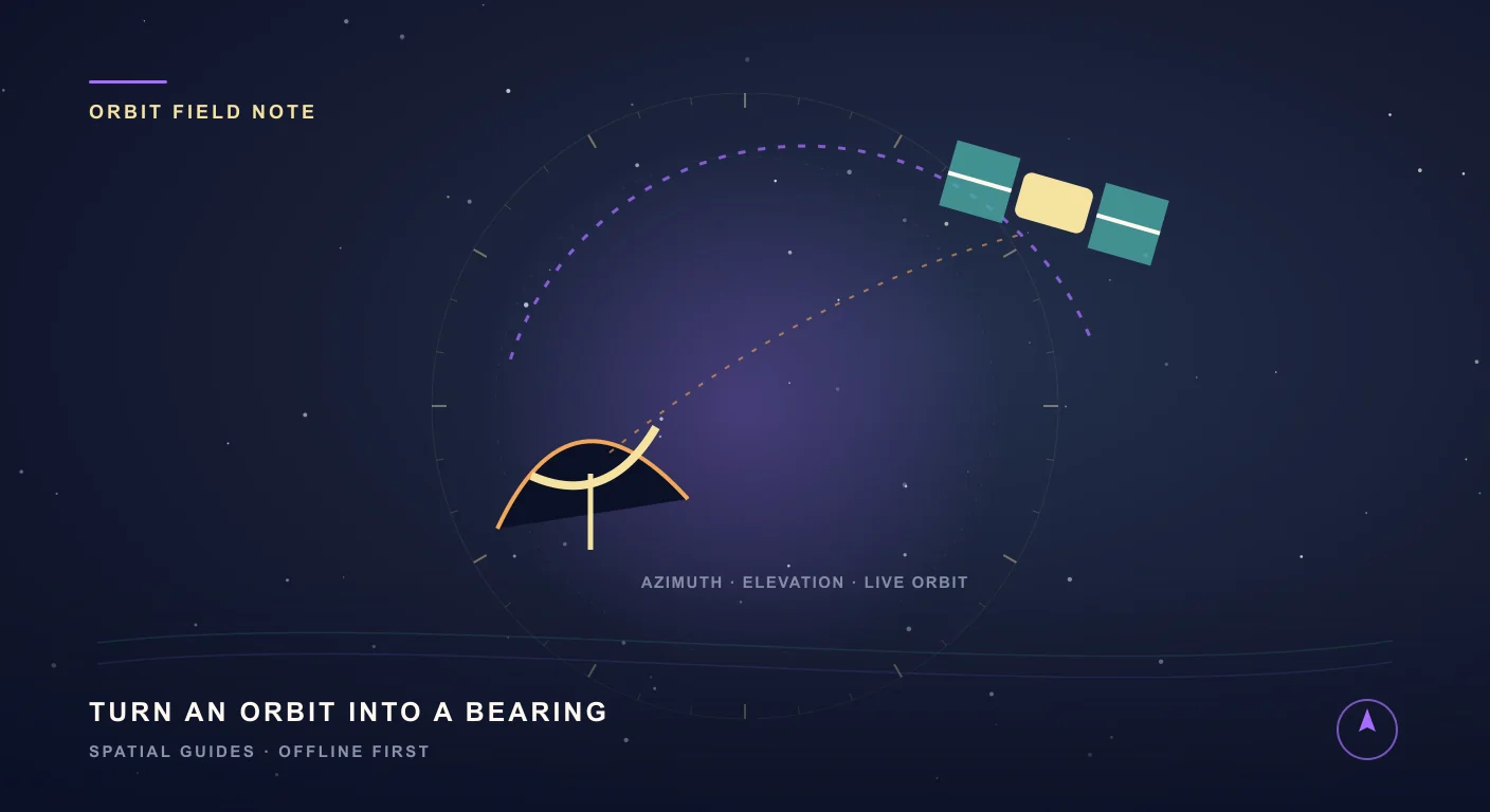
How to Track Satellites with SIMT: Aim a Dish, Spot the ISS, and More
From aiming a satellite dish to catching the ISS overhead, SIMT turns any satellite into a direction you can actually point at. Feed it a TLE and it computes the live azimuth, elevation, and range on your device, then guides you there with the compass and Iris AR, even with no signal.