
Your phone already knows where the satellites are
There are thousands of useful objects circling overhead right now, from the International Space Station to the geostationary satellite beaming your TV signal. The hard part has never been knowing they exist. It is knowing exactly where to look, or exactly where to point, at this minute, from where you happen to be standing. SIMT is built to answer that question precisely.
This guide walks through the satellite jobs SIMT does well: lining up a satellite dish, spotting the ISS and bright passes, pointing at any object you can name, and reading the positioning satellites that keep your phone located. They all run on the same simple idea, so let us start there.
How SIMT turns a satellite into a direction you can point at
Every satellite in SIMT starts life as an orbital target built from a TLE, the two-line element set that describes an orbit at a known moment. You can paste a TLE from the clipboard, share one into SIMT from another app, or open a shared link, and SIMT reads the catalog number, checks the line checksums, and flags how fresh the data is so you know whether to trust it.
From that TLE, SIMT propagates the orbit with the SGP4 and SDP4 models, the same physics that mission planners use, and computes where the object is for your exact location and time. The result is four live numbers: azimuth (the compass bearing to it), elevation (how high above the horizon it sits), range (the straight-line distance to it), and altitude (its height above the surface). All of it is calculated on the phone, no server in the loop.
SIMT even labels the orbital region from that live altitude, from very low orbit through LEO, MEO, and GEO out to highly elliptical orbits, so you get a sense of what kind of object you are tracking. Once those angles exist, every pointing tool in the app can aim at it.
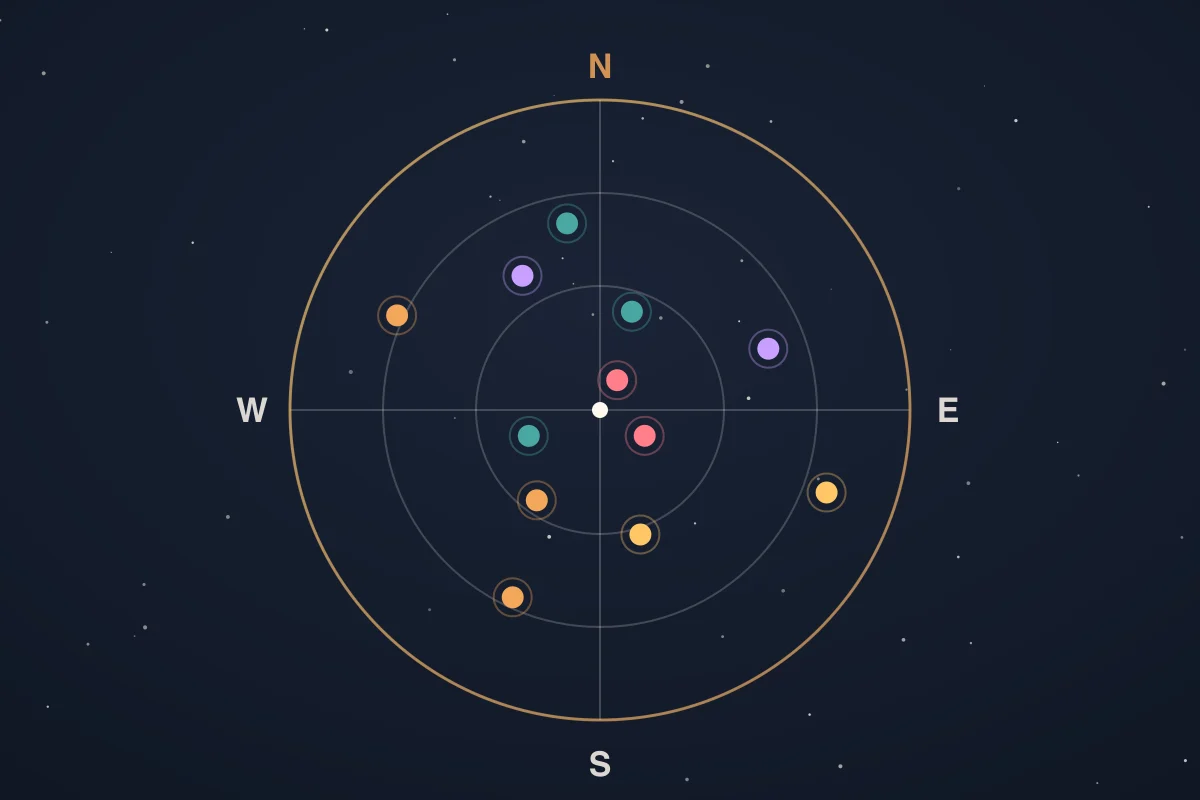
- The Layered Dial and Proximity Star place the satellite around the compass by bearing.
- The Horizon String positions it by both bearing and elevation, so you know how far to look up.
- The target details panel shows the live azimuth, elevation, distance, and altitude, refreshed every second.
- Iris, the AR view, paints the satellite straight onto your live camera feed.
Aim a satellite dish without the guesswork
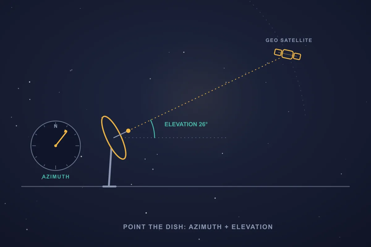
Pointing a fixed dish at a geostationary satellite comes down to two angles: the azimuth, the compass direction to swing the dish toward, and the elevation, how far to tilt it up from the horizon. Get them right and the signal locks in. Get them wrong by a couple of degrees and you get nothing, which is why dish installs are so fiddly when you are guessing.
Add the satellite's TLE as a target and SIMT shows you both angles live, computed for the precise spot you are standing on rather than a rough postcode lookup. Because a geostationary satellite holds its slot over the equator, those numbers stay essentially fixed, so you can read the azimuth and elevation once and dial them straight into the dish.
Better still, open the target in Iris and lift your phone: the marker sits exactly where the satellite is in the sky, so you can confirm a clear line over the trees and rooftops before you bolt anything to a wall. Use the compass bearing to rotate the dish, and the elevation reading to set its tilt.
Spot the ISS and bright satellite passes
The International Space Station is the crowd favorite, and it is a great first satellite to track. Paste or share in its current TLE and SIMT follows it live, updating its azimuth, elevation, range, and altitude every second as it races across the sky at roughly eight kilometers per second.
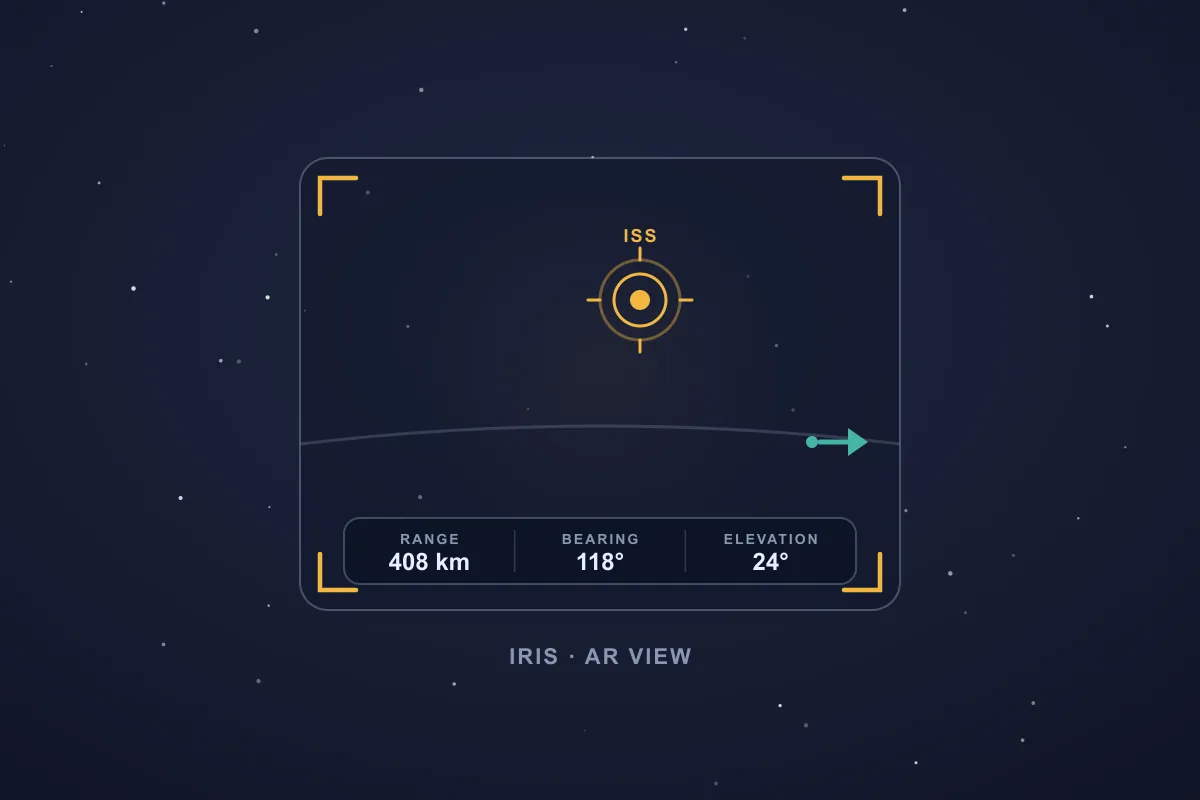
When it climbs above your horizon, raise your phone and Iris paints it onto the camera with its live range, bearing, and elevation on the heads-up readout. That works even in daylight when you cannot see it yet, and even though a camera-based AR engine would have nothing in the frame to lock onto. SIMT does not need to track the image; it already knows where the station is.
The same flow works for any bright object in low orbit: the brighter Starlink units in their early train formation, the Hubble Space Telescope, the Tiangong station, and more. If you can find its TLE, SIMT can point you at it.
Never miss a pass with rise and set alerts

A good pass lasts only a few minutes, so timing is everything. For any satellite target, SIMT searches the propagated orbit and works out the next rise and set, the moments it climbs above and drops back below your local horizon.
Turn on a rise or set alert and SIMT notifies you as the object is about to come over the horizon, so you can be outside and already pointed in the right direction before it appears, rather than catching the tail end of a pass.
Because the propagation runs on device from the stored TLE, those predictions and alerts keep working with no signal at all. Refresh the elements with one tap while you are connected, then head out to a dark field or a remote ridge and let the math keep predicting. Fresh elements, within a few weeks of their epoch, keep the timing sharp.
Point at any satellite you can name
Nothing about SIMT is limited to the famous satellites. Anything with a published TLE becomes a target you can point at, which opens up a long list of practical jobs beyond the ISS and a TV dish.
- Weather and Earth-observation satellites, so you know when a polar-orbiting craft is overhead.
- Amateur-radio satellites, where the live azimuth and elevation are exactly what you need to swing a handheld Yagi or a rotator as the bird passes.
- Starlink trains, to plan a clear-sky window for spotting or photography.
- Research and science craft like Hubble for an observing session.
- A specific navigation satellite, when you want to point at one particular GPS, Galileo, or BeiDou spacecraft rather than analyze the whole constellation.
In every case the workflow is identical: bring in the TLE, and SIMT gives you a live bearing and elevation plus the choice of aiming with the compass, the Horizon String, or Iris. One mental model covers every object in orbit.
See every satellite at once, orbiting a live Earth
Pointing at one satellite is precise, but sometimes you want the whole picture: everything you track, wheeling around the planet at the same instant. That is what the Orrery's geocentric mode is for. Flip the view from the Sun at the center to the Earth at the center, then zoom all the way in, and SIMT redraws your satellites as a living constellation orbiting a blue marble with a quiet You Are Here marker at its heart.
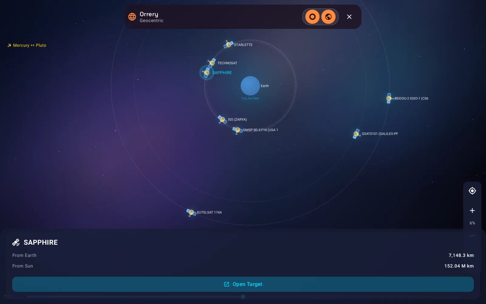
Every object you have added shows up in its true orbital neighborhood. The ISS hugs the planet in low orbit while a Galileo bird and a BeiDou inclined-geosynchronous craft ride the wide outer rings, so the geometry that felt abstract in a single azimuth reading suddenly looks the way it actually is. Tap any satellite and the panel names it and reads its live distance from Earth and from the Sun, then Open Target drops you straight back into the compass, Horizon String, and Iris tools to go and find it in the sky.
The same view scales all the way out, too. Pull back and the geocentric ring gives way to the full heliocentric solar system, Mercury to Pluto, so a single screen carries you from a satellite skimming your rooftop to the planets themselves. And like everything else in SIMT, it runs from your stored elements on device, so the swarm keeps turning whether or not you have a signal.
Understand the positioning satellites behind your fix
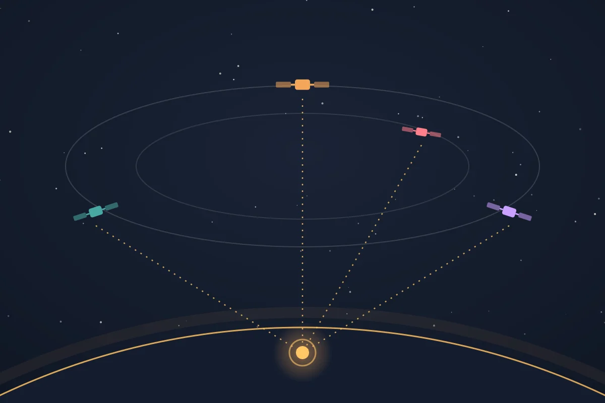
There is a second family of satellites that matters every time you navigate: the positioning satellites your phone uses to know where it is. SIMT can show you what is really going on with them through its raw GNSS engine.
SIMT understands every major system: GPS, Galileo, GLONASS, and BeiDou, plus regional systems like QZSS and NavIC and the SBAS augmentation signals. Its GNSS tool runs the raw measurements and compares three fixes side by side: the fused system location, the classic GPS provider, and SIMT's own raw-measurement solution. You can see how many satellites and which constellations are contributing, the solution mode, and how tight the result is.
That is the practical way to read your positioning satellites. More visible satellites across more constellations means a stronger, more trustworthy fix. Step into the open and the count climbs; stand under a canyon wall or between tall buildings and you can watch it fall. Use it to pick a clear-sky spot before you start a track, to sanity-check a reading, or to understand why a position is drifting.
Keep reading Curious how SIMT turns those raw satellite signals into a position? Here is the whole raw-GNSS engine, from pseudorange to sub-meter fix.How Android Raw GNSS Works — and Why SIMT Builds Its Own Positioning Engine Your phone receives timing signals from dozens of satellites every second. Most apps never touch that data. SIMT does — and it builds a full positioning engine from raw measurements, carrier phase, broadcast ephemeris, and atmospheric models to push accuracy far beyond what standard GPS gives you.Real-world satellite use cases
Put together, these tools cover a surprisingly wide range of people who all need the same thing: a precise, trustworthy answer to where is that satellite, right now, from here.
- Satellite-TV and broadband installers lining up a fixed dish on a geostationary slot.
- Satellite spotters and families catching ISS and Starlink passes from the back garden.
- Astrophotographers planning an ISS or satellite transit shot down to the minute.
- Amateur-radio operators aiming a directional antenna at a low-orbit bird as it passes.
- Hikers, sailors, and overlanders who need offline pass predictions far from any signal.
- Surveyors, drivers, and field workers who want to understand and improve a GNSS fix.
- Teachers and students learning how orbits, azimuth, and elevation actually fit together.
Offline, private, and part of one toolkit
Every satellite calculation here runs on your device. Refresh a TLE once while you have a connection and the predictions, the pointing, and the alerts all keep working with no internet afterward, exactly when you tend to need them most: on a remote install, in a dark-sky field, or off the grid entirely. Your location and saved targets stay on the phone.
And because satellites are just one kind of target in SIMT, they share the same compass, AR, alerting, and Wear OS tools as everything else you track. You do not switch apps to go from finding your way to a trailhead, to aiming a dish, to catching the station overhead.
Keep reading Satellites are just the start of SIMT's sky side — planets, Moon phases, and a live Orrery round it out, all offline.Offline Astronomy App for Planets, Moon Phases, Satellites, and Sky Tracking Most astronomy apps depend on a constant internet connection. SIMT calculates planetary positions, Moon phases, satellite passes, and celestial targets entirely on device, so the sky tools keep working even when you are off the grid.A satellite is just a direction you cannot see yet. SIMT's job is to hand you that direction precisely, then help you point at it.
Questions answered in this guide
Can SIMT help me aim a satellite dish?
Yes. Add the geostationary satellite's TLE as a target and SIMT shows the live azimuth and elevation to point the dish, computed for your exact location. Open it in Iris to see the spot in the sky before you mount the dish. The LNB skew is set separately on the dish hardware.
How do I track the ISS in SIMT?
Paste or share the current ISS TLE into SIMT to create an orbital target. SIMT then shows its live azimuth, elevation, range, and altitude, the next rise and set times, and can paint it onto your camera in the Iris AR view. There is no built-in satellite catalog, so you supply the TLE.
Does satellite tracking work offline?
Yes. SIMT propagates orbits on device with SGP4, so once a TLE is stored, tracking, pointing, and rise and set alerts all work with no connection. Refresh the elements while online, then track offline for days. Fresh elements keep predictions accurate.
Can SIMT show me GPS and other positioning satellites?
SIMT's GNSS tool uses a raw GNSS engine to show which constellations and how many satellites are driving your fix, and compares fix methods side by side. It is built to analyze positioning quality rather than draw a per-satellite sky map. To point at one specific navigation satellite, add its TLE as a target.
What is the difference between azimuth and elevation?
Azimuth is the compass bearing to an object, measured around the horizon, and elevation is how high it sits above the horizon. Together they pin down a direction in the sky, which is exactly what you need to aim a dish, an antenna, or your phone at a satellite.
Do I need ARCore or special hardware to point at satellites?
No. SIMT's Iris view uses your phone's orientation sensors and the camera's real lens geometry, not ARCore or a depth sensor, so it works on a wide range of Android phones and fully offline. That is also why it can mark satellites a camera could never lock onto on its own.
More from SIMT Blog
Astronomy guide
Offline Astronomy App for Planets, Moon Phases, Satellites, and Sky Tracking
Most astronomy apps depend on a constant internet connection. SIMT calculates planetary positions, Moon phases, satellite passes, and celestial targets entirely on device, so the sky tools keep working even when you are off the grid.
Engineering deep dive
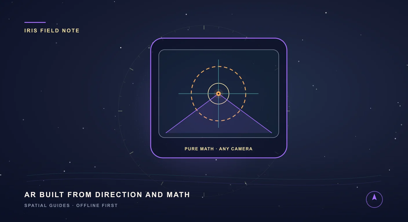
Iris: AR on Any Phone, Powered by Math Instead of ARCore
Most AR apps lean on ARCore and a certified device list. Iris takes a smarter route: it paints any target onto your live camera with pure mathematics, so augmented reality runs on almost any phone, works offline, and barely touches the battery.