
Augmented reality, without the augmented-reality hardware
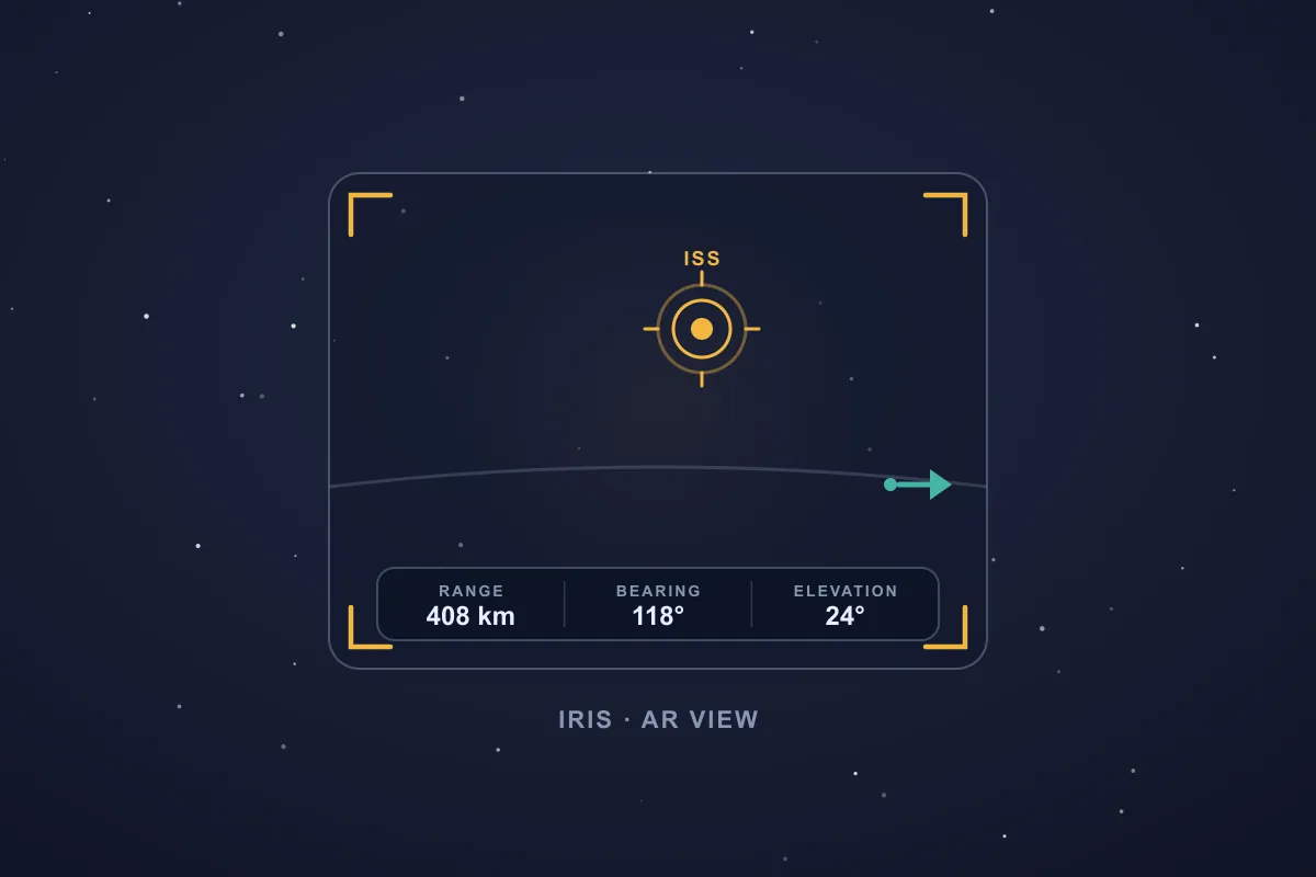
Most augmented-reality apps reach for a heavy framework — Google's ARCore, a SLAM engine, sometimes a depth sensor — to understand the world through the camera. Iris asks a simpler question. It does not need to map your living room or detect the floor. It needs to answer one thing precisely: if a target sits at this bearing, this elevation, and this distance, where exactly should it appear in the frame right now? That is a geometry problem, and geometry runs on every phone.
So Iris paints the target straight onto the camera feed. When it is in front of you, a marker locks onto it. When it is off-screen, an arrow points the shortest way to swing the phone. A heads-up readout keeps its live range, bearing, and elevation on screen, turning an abstract heading into a point you can actually look at.
Why SIMT skips ARCore
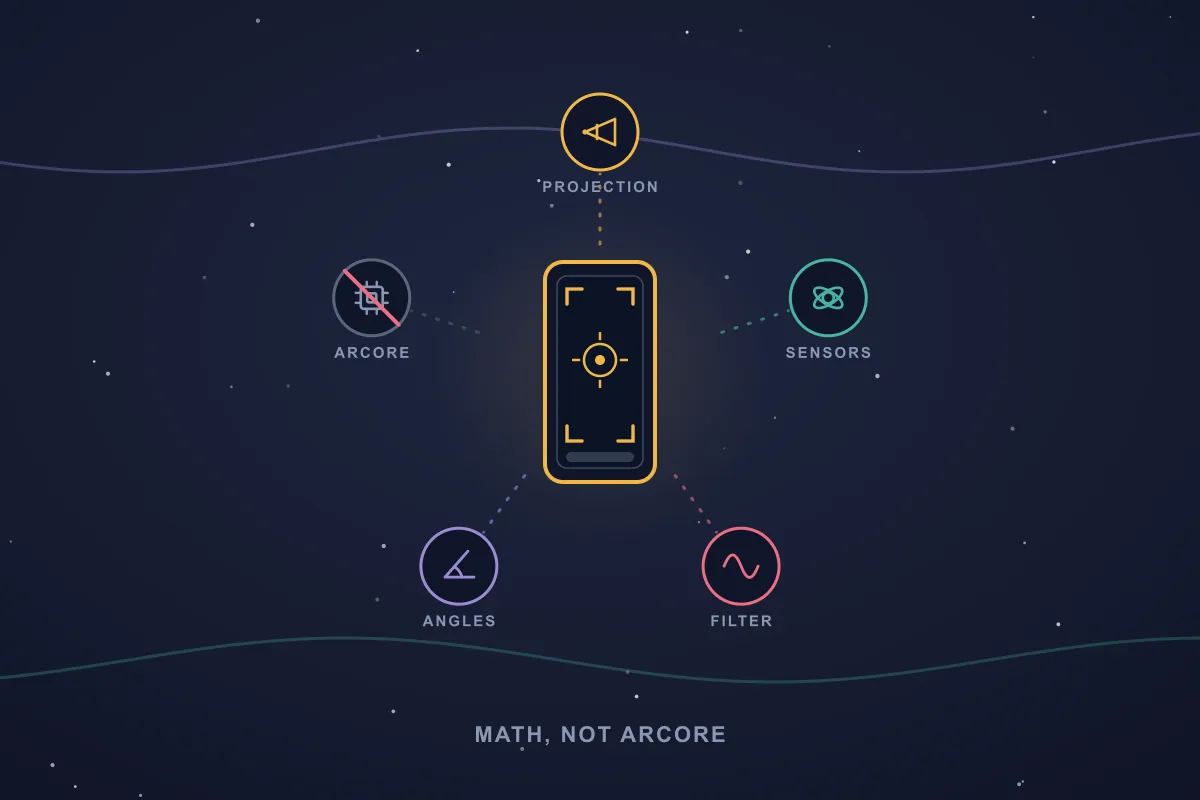
ARCore is brilliant at what it is built for — anchoring virtual furniture to your floor by tracking visual features frame to frame. But for Iris that power is the wrong tool. Visual tracking needs texture and light it often does not have, it cannot anchor to a mountain ten kilometres away or to the Moon, it is gated behind Google Play Services for AR and a certified-device list, and it asks a lot of the CPU, GPU, and battery.
Iris needs far less than a full AR framework. Three inputs are enough:
- Where the phone is pointing, from the rotation-vector sensor — Android's fusion of the accelerometer, magnetometer, and gyroscope into one smooth orientation.
- Where the target is, as a bearing, elevation, and range computed from coordinates or, for sky objects, from astronomy.
- What the camera actually sees, from the lens's true field of view.
Every one of those is available on virtually any Android phone with a compass and a camera. So Iris reaches devices ARCore never supported, keeps working with no connection at all, and stays honest about the far-away and overhead targets that feature-tracking AR simply cannot hold.
Keep reading Track+ makes the opposite bet — it leans on the visual tracking Iris skips, fusing it with dead reckoning to keep positioning you when GPS dies.SIMT: Revolutionizing indoor & complex navigation Track+ is SIMT's answer to the places where GPS collapses: underground parking, stairwells, malls, stations, tunnels, and dense indoor spaces. It combines pedestrian dead reckoning, visual-inertial odometry, barometer altitude, magnetic and Wi-Fi fingerprinting, and beta audio stride detection into one on-device positioning pipeline.From a place on Earth to a pixel on your screen
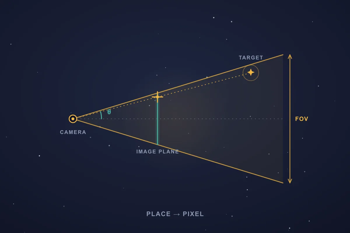
Here is the heart of Iris — the same world-to-screen transform that 3D engines use, run once per frame on the phone.
- Locate the target. For a place, SIMT computes the great-circle bearing and distance to it, plus the elevation angle from the height difference. For a sky target, an ephemeris model gives the Sun, Moon, a planet, or a satellite's azimuth, elevation, and range.
- Find where the phone points. The rotation-vector sensor delivers a device-to-world rotation matrix, corrected for your local magnetic declination so the marker does not drift sideways by the 5–15° that magnetic north can differ from true north.
- Turn the target into a direction. Its bearing and elevation become a single East-North-Up unit vector — a pure 3D arrow aimed at the target.
- Rotate it into the camera's view. Multiplying by the transpose of the orientation matrix expresses that arrow in the camera's own frame: left and right, up and down, forward and back.
- Project it onto the screen. A classic pinhole-camera projection divides by depth and scales by the focal length — one over the tangent of half the field of view — to land the marker on an exact pixel. Anything behind the camera is dropped, and off-screen targets become a pointing arrow.
The payoff: the marker sits precisely where the target would be if you had x-ray eyes for distance — and it tracks in real time as you turn, tilt, and walk.
Measuring your lens, not guessing it
A projection is only as accurate as the field of view you feed it. Guess a generic 60° and the marker creeps away from its anchor toward the edges of the frame. So Iris does not guess. It reads the real optics straight from the camera hardware — the physical sensor size and focal length — and computes the field of view as two times the arctangent of the sensor width over twice the focal length.
- It swaps horizontal and vertical field of view to match how you are holding the phone.
- It corrects for the crop when the preview's aspect ratio does not match the sensor, which quietly narrows the real field of view.
- It rescales the field of view as you pinch to zoom — the effective view shrinks as two times the arctangent of tan(half the field of view) divided by the zoom — so the marker stays glued to its target even at high magnification.
- It reads the lens's distortion profile and undistorts the projection, so the marker stays true even near the edges of the frame, where wide and ultrawide lenses bend straight lines.
This is the difference between AR that looks roughly right and AR that stays locked to the real world as you move, zoom, and switch lenses.
Keeping the marker rock-steady
Raw phone sensors are noisy, and naive smoothing makes things worse: averaging the numbers in a rotation matrix quietly breaks it, producing wobble and swirl even when the phone is perfectly still. Iris smooths the motion the right way.
- A One Euro filter applied in quaternion space: it represents the orientation as a unit quaternion and filters that, so the result stays a clean rotation — responsive when you move quickly, calm when you hold still.
- Gram-Schmidt re-orthogonalization keeps the rotation mathematically valid frame after frame, with no creeping shear or scale.
- When precision matters, aim the crosshair at the Sun or Moon and calibrate — Iris compares where that body truly is against where your phone thinks it is and cancels the leftover bias in both heading and tilt. Continuous magnetic-declination correction keeps true and magnetic north aligned on top of that.
- When it senses a noisy magnetic field — near a car, a speaker, or rebar — Iris flags it and shows the quick figure-eight motion that recalibrates the compass, so you can trust where it points.
The same math points at the sky
Because every target boils down to a bearing, an elevation, and a range, the exact same projection that pins a marker to a far-off peak also paints the Sun, the Moon, the planets, and satellites like the ISS onto your camera — computed from orbital data, day or night, completely offline. A feature-tracking AR engine could never anchor to those: there is nothing in the frame to track. Iris does not need to track anything. It already knows where they are.
Keep reading Want to catch the ISS in that camera view? Here is how SIMT predicts satellite passes and tells you exactly where to look.How to Track Satellites with SIMT: Aim a Dish, Spot the ISS, and More From aiming a satellite dish to catching the ISS overhead, SIMT turns any satellite into a direction you can actually point at. Feed it a TLE and it computes the live azimuth, elevation, and range on your device, then guides you there with the compass and Iris AR, even with no signal.Why this makes SIMT a genuinely smart app
The easy way to add AR is to bolt on a big framework and inherit its limits. The smart way — the SIMT way — is to notice that the phone already affords everything the problem needs, and to solve it with geometry. The reward is not academic: AR that runs on a far wider range of devices, works with no signal, barely touches the battery, and stays accurate on targets that mainstream AR cannot even attempt.
Iris is augmented reality reduced to its essence: know where you are, know where the target is, and do the math. No special hardware required.
The short version
Iris turns a compass bearing into something you can point at and follow, by simulating AR with pure mathematics instead of ARCore. Orientation sensors, the camera's true lens geometry, an East-North-Up direction vector, a pinhole projection, and careful filtering — that is the whole trick, and it is enough to put a steady, accurate marker on almost any Android phone.
It is a small showcase of how SIMT is built: lean, offline-first, and clever where it counts. The result feels like premium AR, without asking for premium hardware.
Questions answered in this guide
Does Iris need ARCore or special AR hardware?
No. Iris does not use ARCore, any AR SDK, or a depth sensor. It simulates augmented reality with your phone's standard orientation sensors, the camera's real lens geometry, and a chain of math, so it runs on a wide range of Android phones.
Will Iris work on my phone?
If your Android phone has a compass (magnetometer) and a camera — which nearly all do — Iris should work, including budget and older devices that ARCore never supported.
Does Iris work offline?
Yes. The projection is pure math on local sensor data, and sky positions come from on-device models, so Iris works with no internet connection at all.
How accurate is the Iris marker?
Iris uses your lens's true field of view from the camera hardware, undistorts the projection toward the edges, corrects for magnetic declination, and smooths the orientation, so the marker stays locked to its real-world point as you turn, zoom, and switch lenses. Accuracy depends mainly on compass calibration; Iris detects interference and prompts a quick figure-eight recalibration, and for pinpoint alignment you can aim at the Sun or Moon and calibrate out any leftover heading or tilt bias.
Does Iris drain the battery like heavy AR apps?
Much less. Without ARCore's continuous visual tracking, Iris mostly reads lightweight sensor data and runs a little geometry per frame, so it stays light on CPU, GPU, and battery.
Can Iris show satellites and planets?
Yes. Because it works from bearing, elevation, and range, Iris paints sky targets — the Sun, Moon, planets, and satellites like the ISS — onto your camera using orbital data, even though a camera-based AR engine would have nothing to track.
More from SIMT Blog
Beta release
Introducing SIMT: The First Light Beta
Before the Constellation and Cosmos updates, there was First Light: the very first public SIMT beta. Here is the foundation it laid, an offline compass and a whole toolkit for capturing, measuring, and sharing the places that matter, with every byte kept on your device.
Astronomy guide
Offline Astronomy App for Planets, Moon Phases, Satellites, and Sky Tracking
Most astronomy apps depend on a constant internet connection. SIMT calculates planetary positions, Moon phases, satellite passes, and celestial targets entirely on device, so the sky tools keep working even when you are off the grid.