
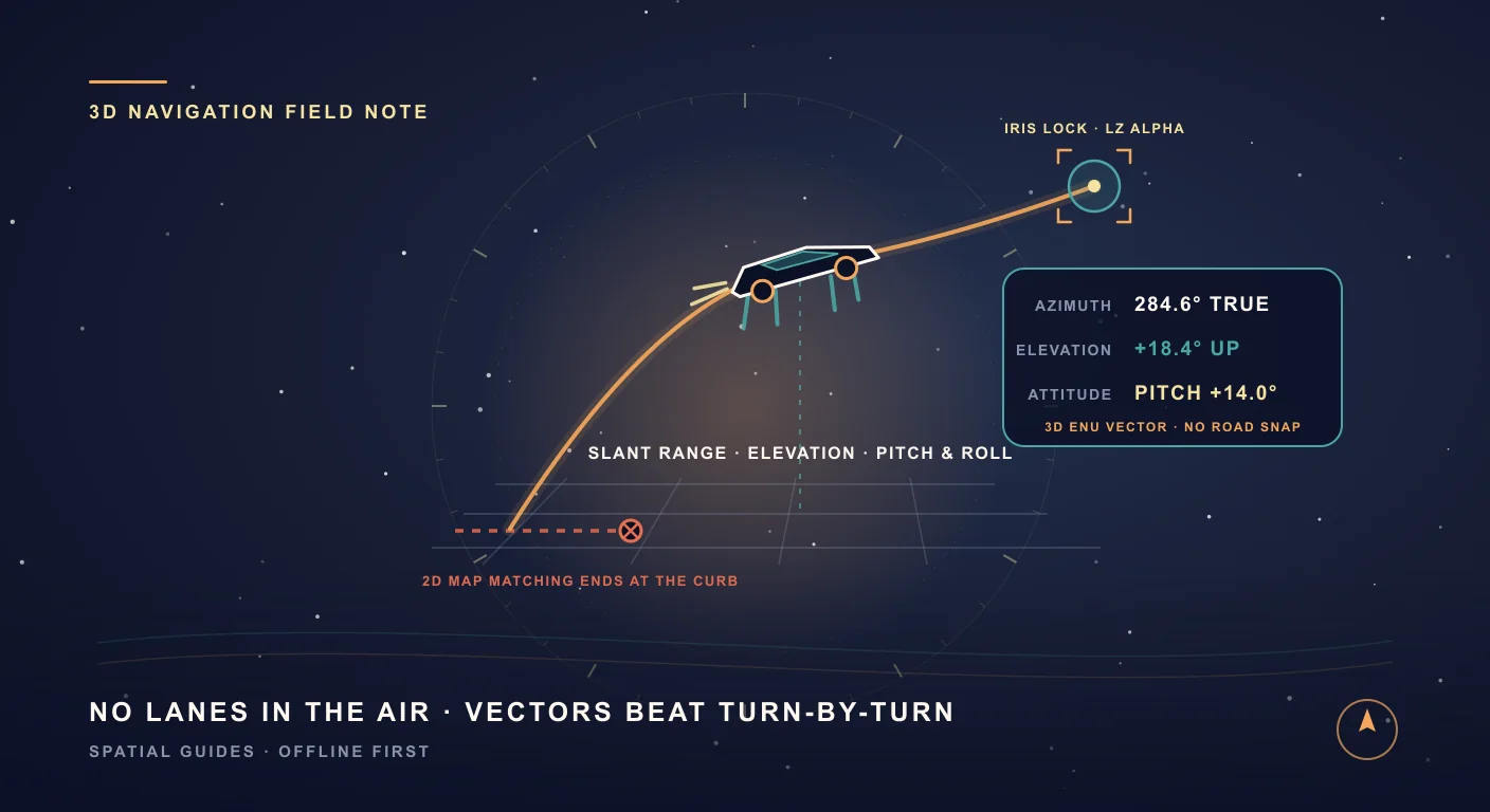
In McGregor, Texas, a car just ran out of road—on purpose
For nearly nine years, Elon Musk’s promise that the second-generation Tesla Roadster would pack SpaceX rocket thrusters and briefly fly sounded like the ultimate late-night post. Then, on the evening of October 15, 2026, on the tarmac outside SpaceX’s rocket development facility in McGregor, Texas, a wedge-shaped prototype fired a white plume of pressurized gas and actually lifted off the pavement.
Across two unmanned demonstrations covered live by AP News, The Verge, and AVweb, the prototype pulled off two stunts that no normal street map has vocabulary for. First, it used four underbody electric suction fans and deployable aero skirts to crawl up a vertical ramp until it was clinging upside down, before kicking off the inverted ledge, rotating in midair with cold-gas thrusters, and setting down on its wheels. Next, it accelerated down the strip and blasted itself airborne over a parked lineup of a Cybercab, Cybertruck, Tesla Semi, Model Y, and Model 3.
Even with every caveat firmly in place, watching a sports car vault over a semi-truck forces a delightfully absurd software question: what happens to your navigation app when the road underneath you becomes optional?
Three trims, 600 liters of compressed gas, and 10 rocket nozzles
To understand why a vehicle like this breaks conventional car software, look at what Tesla engineering vice president Lars Moravy and chief designer Franz von Holzhausen detailed in MotorTrend’s technical walkaround and TechCrunch’s launch report. Rather than one car, Tesla split the redesigned Roadster platform into three escalating physics experiments:
- Roadster Performance (Road Ready): A two-seater built around four rear underbody electric fans and drop-down "aero fences" that seal the undercarriage to pull up to 2 Gs of negative-pressure suction, paired with an active rear wing driven by actuators borrowed from the Tesla Optimus robot. Claimed 0–60 mph: under 1.6 seconds.
- Roadster Thrust (Race Ready): Keeps both seats and the suction package, then fills the rear luggage bay with a 200-liter composite overwrapped pressure vessel (COPV) pressurized up to 10,000 psi feeding four rear cold-gas thruster (CGT) nozzles. Claimed 0–60 mph: under 0.9 seconds.
- Roadster Rocket (Air Ready): An invite-only single-seater that deletes the passenger seat to fit a second, double-size COPV—bringing total onboard gas volume to 600 liters (~250 kg of compressed air/nitrogen) piped to 10 cold-gas thruster nozzles around the perimeter: four at the tail for forward thrust, four behind the wheels pointing down for vertical lift, and two at the nose pointing sideways for yaw and roll control. Claimed 0–60 mph: under 0.59 seconds.
Notice what happens as you move up that spec sheet. A normal car has two degrees of freedom on a flat sheet of asphalt: steering angle and wheel speed. A vehicle with underbody suction fans that climbs vertical walls—or 10 perimeter thrusters that command lift, pitch, yaw, and barrel rolls—lives in six degrees of freedom: latitude, longitude, altitude, pitch, roll, and true heading.
Why standard turn-by-turn maps panic the second your tires leave the asphalt
Open Google Maps, Apple Maps, Waze, or almost any in-dash automotive navigation screen, and you are looking at a very specific data structure: a planar directed graph. Roads are one-dimensional edges. Intersections are nodes. Turn restrictions and lane arrows are edge weights.
Because consumer GPS receivers bounce around by several meters between buildings, road navigation apps run a hidden step called map matching. Every second, the app takes your raw coordinate, searches for the nearest paved street polygon, and snaps your blue dot onto that lane. If you are driving a sedan down Interstate 35, map matching is magic. It hides sensor noise and keeps your arrow neatly centered on the highway.
The instant a vehicle hops an obstacle, cuts across an unpaved test range, climbs a banked wall, or lifts twenty feet into the air, map matching turns from a helper into a hallucination engine:
- False lane snapping: Jump over a congested interchange or cruise across an open desert pan, and a 2D map drags your cursor sideways onto whatever service road or cul-de-sac passes underneath your shadow.
- Useless turn instructions: "In 300 feet, keep right at the fork" means nothing when you are clearing a row of parked trucks on compressed nitrogen or lining up on a landing pad across a field.
- Altitude blindness: A flat map treats a point on the tarmac and a ledge 40 feet above it as the exact same pixel.
- Attitude amnesia: Standard map apps have no idea whether your nose is pitched up 15 degrees, banked into a roll, or inverted on a ramp ceiling.
A street map asks which lane you are allowed to follow. A spatial instrument asks where your nose is pointed in three-dimensional space—and what sits along that vector.
Five reasons SIMT already thinks like a 3D flight deck
SIMT was never built around a turn-by-turn street graph. Its name comes from the Arabic al-simt—the root of azimuth and zenith—because it treats navigation as a 3D geometry problem between where you are, how your device is oriented in space, and where your target sits above, below, or beyond the horizon. Here is why that architecture fits airborne hops, eVTOLs, and off-grid vehicles far better than a 2D road map.
- True 3D vectors (Azimuth + Elevation Angle + Slant Range): Drop a target on a landing zone, a ridgeline, a support truck, or a satellite overhead, and SIMT computes the exact great-circle azimuth, the vertical elevation angle from your altitude difference, and the direct line-of-sight distance. No road graph required.
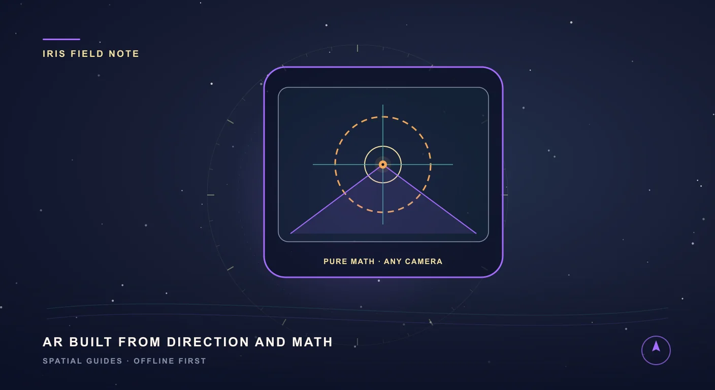
- Iris Camera HUD (AR without ARCore): Mainstream AR toolkits like ARCore hunt for flat living-room floors and lose tracking the moment you move fast or tilt toward the sky. SIMT’s Iris projects any 3D target straight onto your live camera feed using East-North-Up (ENU) vector math, rotation-vector sensor fusion, One Euro quaternion smoothing, and your camera lens’s true field of view. If your landing zone is off-screen during a yaw maneuver, an edge arrow points the shortest rotation back onto target.
- Plumb Bob Attitude & Tilt Gauge (Pitch, Roll, and Gravity): Whether a vehicle is climbing a steep ramp, testing underbody downforce, or settling back onto its wheels, attitude matters. SIMT’s Plumb Bob fuses accelerometer and gyroscope gravity vectors to display live two-axis pitch and roll in degrees, percent grade, or rise-over-run ratio—complete with custom zero calibration for angled dash mounts.
- Heading-Up Minimap Radar with Rim Blips: At sub-second acceleration, nobody is reading 10-point street labels on a static north-up map. SIMT’s Minimap rotates smoothly around your live heading, plotting nearby waypoints at true scale inside the radar sweep while clamping distant targets cleanly to the outer compass rim so you never lose track of your objective.
- Custom Raw GNSS Engine + Track+ Dead Reckoning: When thruster plumes, hangars, or canyon walls degrade satellite reception, SIMT does not fall back to snapping you onto a fake road. Its Android raw GNSS engine solves pseudoranges, carrier phase, dual-band L1/L5 ionospheric delays, and NTRIP RTK corrections directly, while Track+ blends inertial sensors, barometric altitude, and visual odometry when GPS drops out.
And when you are out on a remote test strip like McGregor—or a dry lakebed where cell towers are miles away—SIMT Connect hands off target coordinates and live positions peer-to-peer between phones over QR codes, Nearby connections, or local Wi-Fi without touching a cloud server.
Questions answered in this guide
Did the new Tesla Roadster really fly during its October 2026 reveal?
During an autonomous, unoccupied demonstration at SpaceX's McGregor, Texas test facility on October 15, 2026, a next-generation Tesla Roadster prototype used 10 cold-gas thrusters fed by 600 liters of compressed gas to perform short, controlled airborne hops—including vaulting over five parked Tesla vehicles and dismounting from an inverted ramp. It demonstrated brief thruster-assisted hops rather than sustained cross-country flight.
Is the flying Tesla Roadster Rocket variant street-legal?
No. Tesla explicitly lists the single-seat Roadster Rocket ('Air Ready') trim as 'not approved for public road use' and 'invite only,' with production targeted for 2028 and no public FAA certification pathway announced as of October 2026.
Why do standard navigation apps fail when a vehicle leaves the road?
Standard turn-by-turn apps rely on map matching, which snaps your GPS coordinates onto the nearest paved road polyline and calculates routes from intersection to intersection. Once a vehicle leaves the road grid—whether off-roading, crossing water, or lifting into the air—road snapping pulls your position onto false nearby streets and ignores elevation angles and pitch/roll attitude.
How does SIMT navigate in 3D without a road network?
SIMT calculates direct 3D spatial vectors—great-circle azimuth (bearing), vertical elevation angle from altitude differences, and line-of-sight range—to any target. It pairs those vectors with Iris camera AR (which projects targets onto the live camera feed using sensor math without ARCore), Plumb Bob pitch-and-roll attitude sensing, a heading-up Minimap radar, and a custom Android raw GNSS + Track+ positioning engine.
Can SIMT replace certified aircraft avionics?
No. SIMT is a consumer smartphone and smartwatch orientation, mapping, and measurement utility for ground exploration, astronomy, and situational awareness. It is not certified avionics and must never be used as a primary flight instrument.
More from SIMT Blog
Engineering deep dive
Iris: AR on Any Phone, Powered by Math Instead of ARCore
Most AR apps lean on ARCore and a certified device list. Iris takes a smarter route: it paints any target onto your live camera with pure mathematics, so augmented reality runs on almost any phone, works offline, and barely touches the battery.

GTA VI countdown
GTA VI Lands November 19 — Your Free Real-World Minimap Is Ready Now
GTA VI lands November 19, 2026. Before Jason and Lucia pull us into Leonida, turn your Android phone into a free neon, heading-up real-world minimap — and give your navigation reflexes a head start.